
67 streymoy, faroe islands

First card from the Faroe islands! This is one of my dream destinations, that's why I am especially excited.
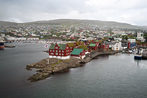
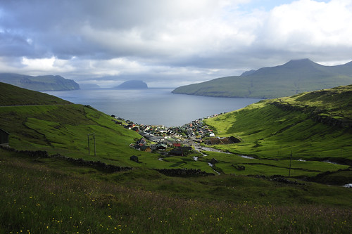
Faroe islands consist of 18 major islands, located halfway between Iceland and Norway. It is a self governing region of the Kingdom of Denmark (just like Greenland). Its closest neighbour-island is uinhabited North Rona in Scotland, 260km away. The population is about 48,000, with nearly half of the people living on the Streymoy, the biggest island of the archipelago.On the postcard you can see different views from Streymoy: an aerial view of Kirkjubøur village, with the oldest church on the islands (the black building), Saksun - which used to be a harbour until a storm blocked the inlet, and Vestmanna harbour. The birds in the middle are called Tjaldur - they are the national birds of Faroe islands, and their arrival is celebrated as the start of spring.
Big thanks to Elena for this interesting card!

streymoy
- country
- Faroe islands, sov. state of Denmark
- location
- between Norwegian Sea and Atlantic Ocean
- inhabitants
- 22,400
- biggest town
- Tórshavn
- postcard received
- distance travelled
- ~2273km
- sent from
- Sandvik
2 comments
Bardzo ładna kartka :)
ReplyDeleteładna jak całe Wyspy Owcze ;)
Delete